Turkey's Climate: Temperature Dynamics - kapak
Eğitim#geography#climate#temperature#turkey

Turkey's Climate: Temperature Dynamics

An academic overview of temperature characteristics and influencing factors across Turkey, essential for understanding its diverse climate zones and for educational contexts like the KPSS examinations.

ebrarr_0February 25, 2026 ~20 dk toplam
01

Sesli Özet

6 dakika

Konuyu otobüste, koşarken, yolda dinleyerek öğren.

Sesli Özet

Turkey's Climate: Temperature Dynamics

0:005:49
02

Flash Kartlar

25 kart

Karta tıklayarak çevir. ← → ile gez, ⎵ ile çevir.

1 / 25
Tüm kartları metin olarak gör
  1. 1. What is the primary focus of studying temperature in Turkey's climate?

    The primary focus is to understand the diverse climatic conditions across Turkey. Temperature study is fundamental because Turkey's geographical position, varied topography, and proximity to different bodies of water create a complex interplay of factors that dictate its thermal regimes. This understanding is crucial for academic study and assessments.

  2. 2. What are the main geographical factors that influence temperature distribution in Turkey?

    Temperature distribution in Turkey is primarily influenced by latitude, altitude or elevation, proximity to seas, the continental effect, relief and topography (especially mountain ranges), and the influence of various air masses. These factors interact to create the country's diverse thermal patterns.

  3. 3. How does latitude affect temperature distribution in Turkey?

    As Turkey is located in the Northern Hemisphere, latitude causes a general decrease in average temperature from south to north. This is a direct result of the diminishing angle of incidence of solar radiation as one moves further from the equator, leading to less intense heating in northern regions.

  4. 4. Explain the impact of altitude on temperature in Turkey.

    Altitude is a paramount factor in Turkey, which has an average elevation exceeding 1,100 meters. There is a substantial decrease in temperature with increasing height, a phenomenon known as the lapse rate. This means highland areas experience significantly cooler conditions compared to coastal plains, even at similar latitudes.

  5. 5. How do the seas influence temperature along Turkey's coastal belts?

    The Mediterranean, Aegean, and Black Seas exert a moderating influence on coastal temperatures. They prevent extreme temperature fluctuations, leading to milder winters and less scorching summers. Maritime air masses also carry moisture, contributing to higher humidity and reducing the daily temperature ranges.

  6. 6. Describe the "continental effect" on temperature in Turkey's inland regions.

    The continental effect is pronounced in Turkey's inland regions, far from the sea. These areas experience greater temperature extremes, characterized by very cold, often snowy winters and hot, dry summers. This is because land has a lower specific heat capacity than water, causing it to heat up and cool down more rapidly.

  7. 7. How do mountain ranges like the North Anatolian and Taurus Mountains affect temperature distribution?

    The North Anatolian Mountains and the Taurus Mountains, running parallel to the coastlines, act as significant barriers. They prevent maritime influences from penetrating far inland, thereby enhancing the continental effect in Central and Eastern Anatolia. These ranges also create rain shadow areas, which can impact cloud cover and solar radiation.

  8. 8. What role do air masses play in Turkey's seasonal temperature patterns?

    Air masses are crucial in dictating Turkey's seasonal temperature patterns and weather events. The country is affected by various air masses throughout the year, including cold polar air masses originating from the north and warm tropical air masses moving in from the south. Their interaction brings about distinct seasonal changes.

  9. 9. Characterize the climate of the Mediterranean and Aegean Coasts of Turkey.

    The Mediterranean and Aegean Coasts are characterized by a climate with mild, rainy winters and hot, dry summers. Average winter temperatures rarely drop below 10 degrees Celsius, while summer averages often exceed 25 degrees Celsius, making these regions popular for tourism.

  10. 10. What are the key temperature characteristics of the Black Sea Coast?

    The Black Sea Coast experiences a more temperate maritime climate. It has mild winters and warm, humid summers. Temperature variations are less extreme here compared to other regions due to consistent maritime influence, and precipitation is distributed relatively evenly throughout the year.

  11. 11. Describe the typical temperature patterns in Central Anatolia.

    Central Anatolia exhibits a typical continental climate. Winters are cold and snowy, with average temperatures frequently falling below freezing. Summers, in contrast, are hot and dry, often reaching 30 degrees Celsius or higher. This region is known for its significant diurnal (daily) and annual temperature ranges.

  12. 12. Why does Eastern Anatolia experience the most severe winter conditions in Turkey?

    Eastern Anatolia experiences the most severe winter conditions due to its high altitude and extreme continentality. This combination leads to prolonged periods of sub-zero temperatures and heavy snowfall. Although summers are relatively warm and dry, the overall annual average temperature in this region is the lowest in the country.

  13. 13. What are the temperature characteristics of Southeastern Anatolia?

    Southeastern Anatolia is influenced by both continental and semi-desert climates. Summers are exceptionally hot and dry, often exceeding 40 degrees Celsius. Winters are relatively mild compared to Eastern Anatolia but can still experience significant cold spells, reflecting a blend of influences.

  14. 14. What is the "lapse rate" and how is it relevant to Turkey's climate?

    The lapse rate refers to the rate at which atmospheric temperature decreases with an increase in altitude. In Turkey, with its high average elevation, the lapse rate is highly relevant as it explains why mountainous regions are significantly cooler than coastal plains, even at similar latitudes.

  15. 15. How does the specific heat capacity of land and water contribute to the continental effect?

    The continental effect is amplified by the differing specific heat capacities of land and water. Land has a lower specific heat capacity, meaning it heats up and cools down more rapidly than water. This causes inland areas to experience greater temperature extremes, with very hot summers and very cold winters.

  16. 16. What are isotherms and what do they visually represent in the context of Turkey's climate?

    Isotherms are lines on a map that connect points of equal temperature. In the context of Turkey's climate, they visually represent temperature distributions across the country, clearly illustrating the thermal gradients and helping to understand how temperature varies regionally.

  17. 17. Which region in Turkey records the highest diurnal and annual temperature ranges?

    Eastern Anatolia records the highest diurnal (daily) and annual temperature ranges. This is primarily due to its high altitude and extreme continental climate, which leads to rapid heating during the day and cooling at night, as well as vast differences between summer and winter temperatures.

  18. 18. Which region in Turkey has the lowest overall annual average temperature?

    Eastern Anatolia has the lowest overall annual average temperature in Turkey. This is a direct consequence of its high altitude and extreme continental climate, which results in prolonged periods of sub-zero temperatures during winter, significantly lowering the yearly average.

  19. 19. What is the general trend of average temperature change from south to north in Turkey?

    There is a general decrease in average temperature from south to north across Turkey. This trend is primarily attributed to the influence of latitude, as the angle of incidence of solar radiation diminishes as one moves northward, leading to less direct heating.

  20. 20. How do coastal regions differ from inland regions in terms of temperature fluctuations?

    Coastal regions, due to the moderating influence of the seas, experience less extreme temperature fluctuations, with milder winters and less scorching summers. Inland regions, conversely, exhibit greater temperature extremes, characterized by very cold winters and hot, dry summers, due to the continental effect.

  21. 21. What is the typical winter temperature range for the Mediterranean and Aegean Coasts?

    Along the Mediterranean and Aegean Coasts, average winter temperatures rarely drop below 10 degrees Celsius. This indicates a mild winter climate, significantly influenced by the moderating effect of the surrounding seas, which prevents extreme cold.

  22. 22. What is the typical summer temperature range for Central Anatolia?

    In Central Anatolia, summers are typically hot and dry, with average temperatures often reaching 30 degrees Celsius or higher. This is a characteristic feature of its continental climate, where land heats up significantly during the warmer months due to less maritime influence.

  23. 23. Which climate type is prevalent in Central Anatolia?

    A typical continental climate is prevalent in Central Anatolia. This climate type is characterized by significant temperature extremes between seasons, with cold, snowy winters and hot, dry summers, reflecting its distance from maritime influences and the rapid heating and cooling of land.

  24. 24. How do mountain ranges contribute to the "rain shadow" effect in Turkey?

    Mountain ranges like the North Anatolian and Taurus Mountains create rain shadow areas by blocking moisture-laden air masses from reaching inland regions. As air rises over the mountains, it cools and releases precipitation on the windward side, leaving the leeward side (rain shadow) drier and often affecting cloud cover and solar radiation.

  25. 25. What are the typical summer temperatures in Southeastern Anatolia?

    Southeastern Anatolia experiences exceptionally hot and dry summers, with temperatures often exceeding 40 degrees Celsius. This extreme heat is a defining characteristic of its continental and semi-desert climate influences, leading to very high summer averages.

03

Bilgini Test Et

15 soru

Çoktan seçmeli sorularla öğrendiklerini ölç. Cevap + açıklama.

Soru 1 / 15Skor: 0

Which of the following factors is NOT explicitly mentioned as a primary influence on temperature distribution in Turkey?

04

Detaylı Özet

4 dk okuma

Tüm konuyu derinlemesine, başlık başlık.

This content is based on a YouTube video.


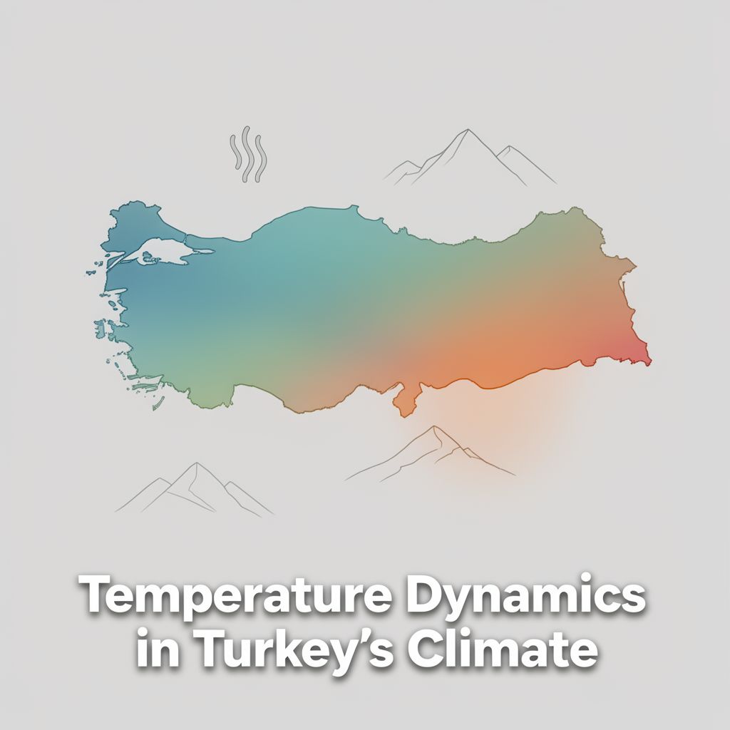
🇹🇷 Turkey's Climate: Understanding Temperature Dynamics

📚 Introduction to Temperature in Turkey's Climate

Temperature is a fundamental element in understanding the diverse climatic conditions across Turkey. Situated at the crossroads of continents, Turkey's unique geographical position, varied topography, and proximity to different bodies of water create a complex interplay of factors that dictate its thermal regimes. This study material systematically explores the primary influences on temperature distribution and the resulting regional characteristics, providing a comprehensive overview essential for academic study and examinations.

🌡️ Key Factors Influencing Temperature Distribution

Several critical geographical and atmospheric factors govern temperature distribution in Turkey.

1️⃣ Latitude

  • Concept: As Turkey is located in the Northern Hemisphere, there is a general decrease in average temperature from south to north.
  • Reason: This reflects the diminishing angle of incidence of solar radiation as one moves away from the equator.
  • Example: Southern coastal areas are generally warmer than northern inland regions at similar altitudes.

2️⃣ Altitude (Elevation)

  • Concept: Altitude is a paramount factor, leading to a substantial decrease in temperature with increasing height.
  • Phenomenon: This is known as the lapse rate.
  • Impact: Turkey's average elevation exceeding 1,100 meters results in cooler conditions in highland areas compared to coastal plains.
  • Example: Mountainous regions like Eastern Anatolia experience significantly colder temperatures than lower-lying areas.

3️⃣ Proximity to Seas (Maritime Effect)

  • Concept: The Mediterranean, Aegean, and Black Seas exert a moderating influence on coastal regions.
  • Impact:
    • Prevents extreme temperature fluctuations.
    • Leads to milder winters and less scorching summers along coastal belts.
    • Maritime air masses carry moisture, contributing to higher humidity.
    • Reduces diurnal (daily) temperature ranges.
  • Example: Coastal cities like Izmir or Antalya have milder winters compared to inland cities at similar latitudes.

4️⃣ Continental Effect

  • Concept: This effect is pronounced in inland regions, far from the moderating influence of the sea.
  • Reason: Land has a lower specific heat capacity than water, causing it to heat up and cool down more rapidly.
  • Impact:
    • Greater temperature extremes.
    • Characterized by very cold, often snowy winters.
    • Hot, dry summers.
  • Example: Central Anatolian cities like Ankara experience much colder winters and hotter summers than coastal cities.

5️⃣ Relief and Topography (Mountain Ranges)

  • Concept: The orientation of mountain ranges significantly impacts temperature distribution.
  • Key Ranges: The North Anatolian Mountains (along the Black Sea) and the Taurus Mountains (along the Mediterranean) run parallel to the coastlines.
  • Impact:
    • Act as barriers, preventing maritime influences from penetrating far inland.
    • Enhance the continental effect in Central and Eastern Anatolia.
    • Create rain shadow areas, affecting cloud cover and solar radiation, which in turn influences temperature.

6️⃣ Air Masses

  • Concept: Turkey is affected by various air masses throughout the year.
  • Types:
    • Cold polar air masses from the north.
    • Warm tropical air masses from the south.
  • Impact: These air masses dictate seasonal temperature patterns and weather events, contributing to the overall thermal variability.

🗺️ Regional Temperature Characteristics and Seasonal Variations

The combined effect of these factors results in distinct regional temperature characteristics and significant seasonal variations across Turkey.

✅ Mediterranean and Aegean Coasts

  • Climate Type: Characterized by a Mediterranean climate.
  • Winters: Mild and rainy 🌧️, rarely dropping below 10°C.
  • Summers: Hot and dry 🔥, often exceeding 25°C.
  • Example: Antalya, Izmir.

✅ Black Sea Coast

  • Climate Type: More temperate maritime climate.
  • Winters: Mild.
  • Summers: Warm and humid.
  • Temperature Variation: Less extreme due to consistent maritime influence.
  • Precipitation: Distributed throughout the year.
  • Example: Trabzon, Rize.

✅ Central Anatolia

  • Climate Type: Typical continental climate.
  • Winters: Cold and snowy ❄️, frequently below freezing.
  • Summers: Hot and dry, often reaching 30°C or higher.
  • Temperature Range: Exhibits significant diurnal and annual temperature ranges.
  • Example: Ankara, Konya.

✅ Eastern Anatolia

  • Climate Type: Most severe winter conditions due to high altitude and extreme continentality.
  • Winters: Prolonged periods of sub-zero temperatures and heavy snowfall 🥶.
  • Summers: Relatively warm and dry.
  • Annual Average: Lowest in the country.
  • Temperature Range: Records the highest diurnal and annual temperature ranges.
  • Example: Erzurum, Kars.

✅ Southeastern Anatolia

  • Climate Type: Influenced by both continental and semi-desert climates.
  • Summers: Exceptionally hot and dry 🔥, often exceeding 40°C.
  • Winters: Relatively mild but can still experience cold spells.
  • Example: Şanlıurfa, Diyarbakır.

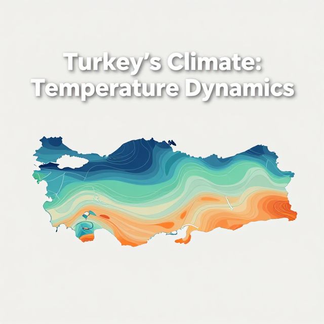
💡 Isotherms: Lines connecting points of equal temperature, visually represent these distributions, clearly illustrating the thermal gradients across the country.

📝 Conclusion: Synthesis of Turkey's Temperature Regimes

Turkey's temperature regimes are a complex outcome of its unique geographical attributes. The interplay of latitude, altitude, proximity to seas, continentality, topography, and prevailing air masses creates a remarkable diversity in thermal conditions across its various regions. From the mild, maritime influences of its coastal zones to the extreme continental characteristics of its interior and eastern highlands, temperature patterns vary significantly both seasonally and geographically. A thorough understanding of these influencing factors and their resulting regional manifestations is essential for comprehensive geographical analysis and for success in educational contexts requiring detailed knowledge of Turkey's physical geography. This systematic approach provides a foundational understanding of temperature as a critical component of Turkey's climate.

Kendi çalışma materyalini oluştur

PDF, YouTube videosu veya herhangi bir konuyu dakikalar içinde podcast, özet, flash kart ve quiz'e dönüştür. 1.000.000+ kullanıcı tercih ediyor.

Sıradaki Konular

Tümünü keşfet
Temperature Dynamics in Turkey's Climate

Temperature Dynamics in Turkey's Climate

An academic overview of temperature distribution and its influencing factors across Turkey, covering geographical principles relevant to climate studies and educational curricula.

5 dk Özet 25 15
Introduction to Geography for KPSS-MEB AGS 2026

Introduction to Geography for KPSS-MEB AGS 2026

This audio summary provides an academic overview of foundational geographical concepts relevant to the KPSS-MEB Field Knowledge Examination, specifically focusing on introductory geography principles.

5 dk Özet 25 15 Görsel
Geographical Location: Absolute and Relative Aspects

Geographical Location: Absolute and Relative Aspects

An academic overview of absolute and relative geographical location, focusing on key concepts and their application to Turkey's geography, relevant for the KPSS examination.

8 dk Özet 25 15
Geographical Location of Turkey: Absolute and Relative Aspects

Geographical Location of Turkey: Absolute and Relative Aspects

This summary explores Turkey's geographical location, differentiating between absolute and relative positions. It covers parallels, meridians, and the geopolitical significance of its unique placement.

7 dk 25
Introduction to Geography for KPSS Examination

Introduction to Geography for KPSS Examination

This summary provides a formal academic overview of introductory geography, covering its fundamental concepts, branches, and key principles relevant for the KPSS examination.

5 dk Özet 25 15 Görsel
Introduction to Geography for KPSS-AGS Examination

Introduction to Geography for KPSS-AGS Examination

This summary provides an academic overview of foundational geographical concepts relevant to the KPSS-AGS examination for prospective geography teachers in Turkey, emphasizing key principles and their educational significance.

6 dk Özet 25 15
Earth Systems and Resources Overview

Earth Systems and Resources Overview

An academic summary of Earth's physical systems, including plate tectonics, soil dynamics, atmospheric composition, global climate drivers, and oceanic phenomena like ENSO.

8 dk 15 Görsel
Exploring the Australian Outback: Geography Basics

Exploring the Australian Outback: Geography Basics

Get ready for your English exam! This podcast explains the basic geography of Australia's vast and unique Outback in simple, easy-to-understand English. You'll learn about its size, climate, and key features.

3 dk Özet 25 15