Landforms of Turkey: Internal and External Forces - kapak
Eğitim#geography#turkey#landforms#geomorphology

Landforms of Turkey: Internal and External Forces

An academic overview of Turkey's landforms, examining the profound impact of both internal (endogenic) and external (exogenic) geological forces on its diverse topography.

roz1509May 13, 2026 ~23 dk toplam
01

Sesli Özet

8 dakika

Konuyu otobüste, koşarken, yolda dinleyerek öğren.

Sesli Özet

Landforms of Turkey: Internal and External Forces

0:007:43
02

Görsel Özet

İnfografik

Konunun tüm parçalarını tek bakışta gör.

Landforms of Turkey: Internal and External Forces - görsel özet infografik
Tam boyutta görüntüle →
03

Flash Kartlar

25 kart

Karta tıklayarak çevir. ← → ile gez, ⎵ ile çevir.

1 / 25
Tüm kartları metin olarak gör
  1. 1. What is the primary focus of Turkish geomorphology?

    Turkish geomorphology primarily focuses on the complex and dynamic landscape of Turkey, which is shaped by a continuous interplay of powerful geological processes. It examines the diverse landforms, from high mountain ranges and extensive plateaus to fertile plains and intricate coastal features, and the fundamental forces that create and modify them.

  2. 2. How are the forces shaping Earth's surface broadly categorized?

    The forces shaping Earth's surface are broadly categorized into internal, or endogenic, forces and external, or exogenic, forces. Internal forces originate from within the Earth, driven by its internal heat, while external forces operate on the Earth's surface, primarily driven by solar energy, gravity, and atmospheric processes.

  3. 3. Define internal (endogenic) forces in the context of geomorphology.

    Internal (endogenic) forces are geological processes driven by the Earth's internal heat. These forces lead to significant crustal deformation, such as the movement of tectonic plates, volcanic activity, and seismic events. They are responsible for creating the primary relief features of the Earth's surface, like mountains and plateaus.

  4. 4. Describe Turkey's strategic location in terms of plate tectonics.

    Turkey is strategically located within the active Alpine-Himalayan orogenic belt. Here, the Anatolian Plate is caught between the converging Eurasian and African/Arabian plates. This complex tectonic setting results in substantial compression and shear stress, which are fundamental to the region's geological activity and landform development.

  5. 5. What is orogenesis, and which major mountain ranges in Turkey are a result of it?

    Orogenesis is the process of mountain building, a primary outcome of internal forces like plate tectonics. In Turkey, it is responsible for the formation of major fold mountain ranges such as the Pontic Mountains in the north and the Taurus Mountains in the south. These ranges are characterized by their parallel alignment and significant elevation.

  6. 6. Explain the role of epeirogenesis in shaping the Anatolian Peninsula.

    Epeirogenesis involves the broad uplift or subsidence of continental masses over large areas, without significant folding or faulting. In Turkey, it has played a crucial role in the general uplift of the Anatolian Peninsula. This slow, large-scale vertical movement contributes to the overall elevation and structural framework of the region.

  7. 7. Name some prominent volcanoes in Turkey and their impact on the landscape.

    Turkey hosts numerous extinct volcanoes, particularly in Eastern and Central Anatolia, including prominent peaks like Mount Ararat, Mount Erciyes, and Mount Hasan. These volcanic activities have resulted in extensive volcanic plateaus and cones, enriching the region's geological diversity. They contribute significantly to the high elevation and unique character of Eastern Anatolia.

  8. 8. Identify the major active fault lines in Turkey and their geomorphological significance.

    Turkey is characterized by active fault lines, notably the North Anatolian Fault and the East Anatolian Fault. These fault lines are responsible for pervasive seismic activity, manifesting as earthquakes. Earthquakes not only cause immediate surface changes but also contribute to long-term landform development through faulting, creating features such as grabens and horsts, prominent in Western Anatolia.

  9. 9. What are grabens and horsts, and where are they prominent in Turkey?

    Grabens are down-dropped blocks of the Earth's crust bounded by parallel faults, while horsts are uplifted blocks between grabens. These features are directly formed by active faulting and are prominent in Western Anatolia. They are significant indicators of the region's ongoing tectonic activity and contribute to its distinctive topography.

  10. 10. Define external (exogenic) forces in geomorphology.

    External (exogenic) forces operate on the Earth's surface, driven primarily by solar energy, gravity, and atmospheric processes. These forces are responsible for the weathering, erosion, and deposition of material. They continuously modify the landscapes initially created by internal forces, shaping features like valleys, plains, and coastal areas.

  11. 11. What are the main types of weathering, and how do they occur?

    Weathering, the disintegration and decomposition of rocks, occurs through physical, chemical, and biological processes. Physical weathering, such as freeze-thaw cycles or salt crystallization, breaks rocks into smaller fragments. Chemical weathering, like the dissolution of limestone, alters the rock's chemical composition. Biological weathering involves the action of living organisms.

  12. 12. Provide examples of physical weathering processes in Turkey.

    Physical weathering in Turkey includes processes like freeze-thaw cycles, which are common in mountainous regions where water repeatedly freezes and thaws in rock cracks, expanding and breaking the rock. Salt crystallization, where salt solutions evaporate and leave behind crystals that grow and exert pressure, is also significant in arid areas.

  13. 13. How does chemical weathering contribute to karst topography in Turkey?

    Chemical weathering, particularly the dissolution of limestone, is widespread in Turkey's Mediterranean regions. This process leads to the development of distinctive karst topography, characterized by features like sinkholes, underground rivers, and caves. The travertines of Pamukkale and numerous cave systems in the Taurus Mountains are prime examples of this phenomenon.

  14. 14. What geological process formed the travertines of Pamukkale?

    The travertines of Pamukkale were formed by chemical weathering, specifically the precipitation of calcium carbonate from thermal waters. As the mineral-rich hot springs emerge and flow down the hillside, carbon dioxide degasses, causing calcium carbonate to precipitate and form the distinctive white terraces and pools. This is a classic example of chemical deposition following dissolution.

  15. 15. List the primary agents of erosion and their significance in Turkey.

    The primary agents of erosion are water, wind, and ice. Fluvial erosion by rivers is highly significant, carving out valleys and transporting vast quantities of sediment. Coastal erosion by wave action sculpts coastlines. Wind erosion is notable in arid regions, and glacial erosion, though limited, shapes high mountain peaks.

  16. 16. What landforms are created by fluvial erosion in Turkey?

    Fluvial erosion by rivers is highly significant in Turkey, carving out valleys, canyons, and gorges. It also transports vast quantities of sediment, which are then deposited to form fertile alluvial plains and deltas. The Çukurova Delta, for instance, is a prominent example of a landform created by extensive fluvial deposition.

  17. 17. How was the fertile Çukurova Delta formed?

    The fertile Çukurova Delta was formed by extensive fluvial erosion and subsequent deposition. Rivers originating in the interior mountains transport vast quantities of sediment downstream. As these rivers reach the flatter coastal areas and slow down, they deposit their sediment loads, gradually building up the delta over time, making it a vital agricultural region.

  18. 18. Where is glacial erosion observed in Turkey, and what features does it create?

    Glacial erosion in Turkey is limited to the highest mountain peaks, where conditions allow for the formation and movement of glaciers. Despite its limited extent, it has shaped distinctive features such as cirques, which are bowl-shaped depressions, and U-shaped valleys, which are characteristic of glacial troughs.

  19. 19. What landforms result from coastal erosion along Turkey's coastlines?

    Coastal erosion, driven by wave action, sculpts a variety of landforms along Turkey's extensive coastlines. These features include rocky cliffs, which are steep rock faces formed by wave undercutting, sea arches, which are natural openings in headlands, and beaches, formed by the deposition of eroded sediment.

  20. 20. Where is wind erosion significant in Turkey, and what landforms does it create?

    Wind erosion, or aeolian processes, is notable in arid and semi-arid interior regions of Turkey. In these areas, strong winds pick up and transport loose sediment, leading to the formation of various desert landforms. These include sand dunes, which are mounds of sand shaped by wind, and other features characteristic of dry environments.

  21. 21. What is mass movement, and where is it prevalent in Turkey?

    Mass movement refers to the downslope movement of rock, soil, and debris under the direct influence of gravity. This includes phenomena like landslides and rockfalls. It is prevalent in steep, tectonically active areas of Turkey, where unstable slopes and seismic activity contribute to its occurrence, significantly modifying the landscape.

  22. 22. Name some landforms created by deposition in Turkey.

    Deposition, the accumulation of eroded material, results in the formation of various landforms in Turkey. These include alluvial fans, which are fan-shaped deposits at the base of mountains, floodplains, which are flat areas adjacent to rivers, deltas, formed at river mouths, and coastal beaches, all vital for agriculture and human settlement.

  23. 23. How do internal and external forces interact to shape Turkey's high mountain ranges?

    The high mountain ranges like the Pontic and Taurus were initially formed by internal forces, specifically orogenesis (mountain building). Subsequently, external forces such as fluvial and glacial erosion continuously sculpt and modify these features. This ongoing interaction leads to rugged terrains, deep valleys, and the complex morphology observed today.

  24. 24. Describe the formation and modification of the Central Anatolian Plateau.

    The Central Anatolian Plateau was primarily uplifted through epeirogenesis, an internal force. Following its uplift, it has been extensively modified by external forces, particularly wind and water erosion. This continuous modification has resulted in a landscape characterized by rolling plains and isolated volcanic cones, showcasing the interplay of forces.

  25. 25. What are the distinctive geomorphological features of Western Anatolia, and how were they formed?

    Western Anatolia is characterized by a series of horst and graben structures, such as the Büyük Menderes Graben. These features directly result from active faulting, an internal force. Subsequent erosion and deposition within these subsided blocks further modify the landscape, creating a unique topography shaped by ongoing tectonic activity.

04

Bilgini Test Et

15 soru

Çoktan seçmeli sorularla öğrendiklerini ölç. Cevap + açıklama.

Soru 1 / 15Skor: 0

What are the two broad categories of forces that shape the Earth's surface, as discussed in the text?

05

Detaylı Özet

5 dk okuma

Tüm konuyu derinlemesine, başlık başlık.

This content is based on a YouTube video.


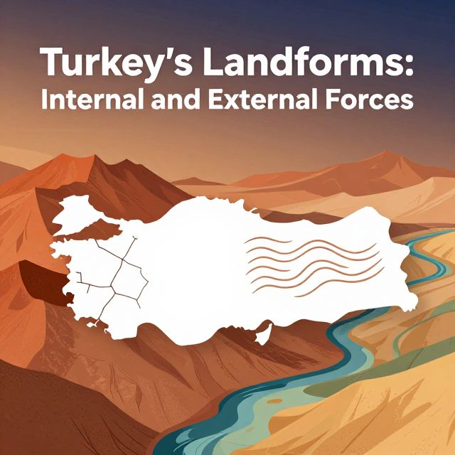
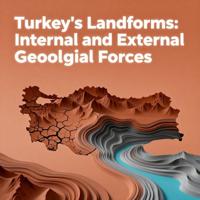
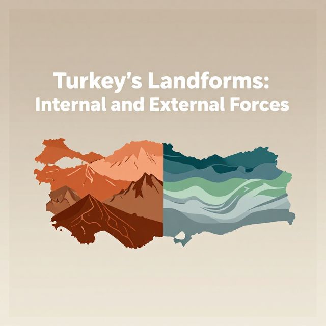
🌍 Turkey's Landforms: Internal and External Forces

Introduction to Turkish Geomorphology 📚

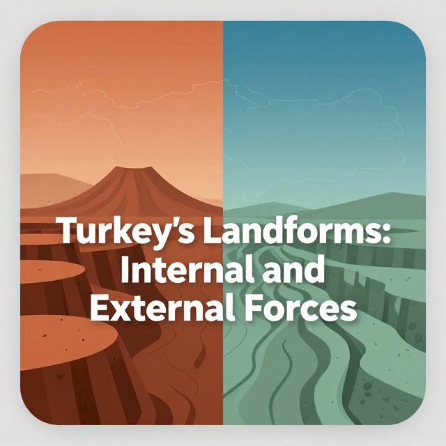
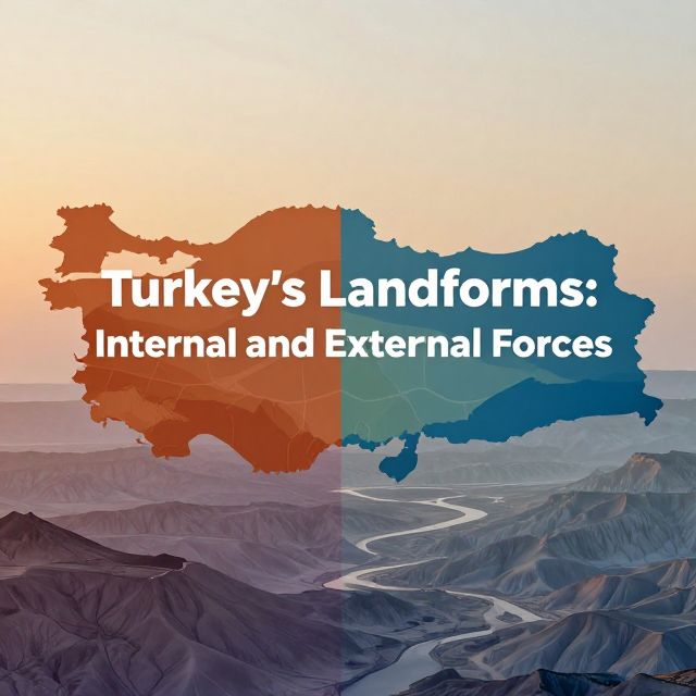
Turkey's landscape is a complex and dynamic result of powerful geological processes. Situated at the convergence of major tectonic plates, Turkey exhibits a remarkable diversity of landforms, from high mountain ranges and extensive plateaus to fertile plains and intricate coastal features. Understanding these landforms requires examining the fundamental forces that create and modify the Earth's surface. These forces are broadly categorized into:

  • Internal (Endogenic) Forces: Originating from within the Earth.
  • External (Exogenic) Forces: Operating on the Earth's surface.

This study material systematically explores these forces and their specific manifestations in the formation of Turkey's distinctive topography.


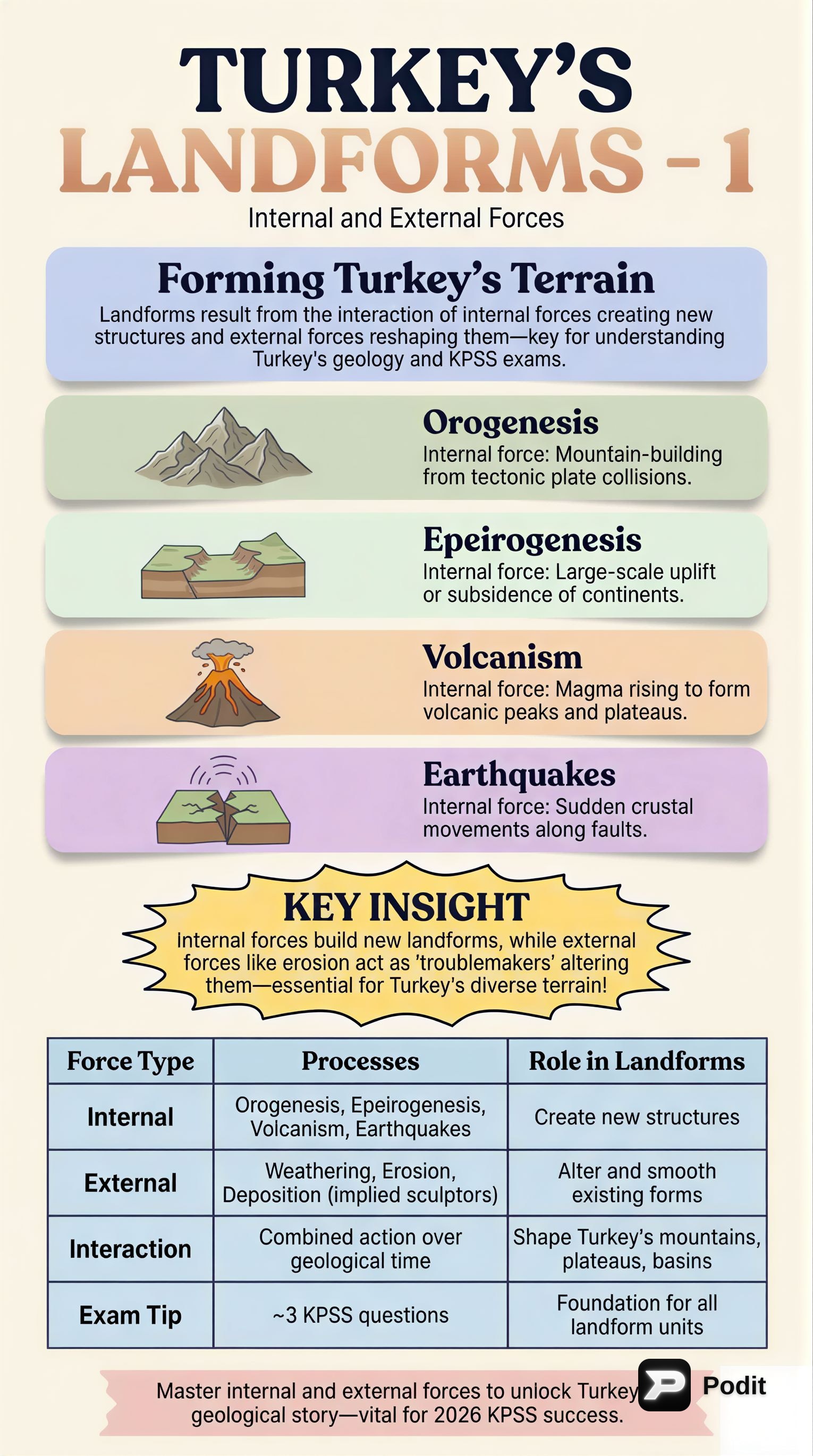
1️⃣ Internal (Endogenic) Forces Shaping Turkey 🌋

Internal forces are geological processes driven by the Earth's internal heat, leading to significant crustal deformation. In Turkey, these forces are predominantly expressed through plate tectonics, volcanism, and seismic activity.

✅ Key Internal Forces:

  1. Plate Tectonics:

    • Turkey is located within the active Alpine-Himalayan orogenic belt.
    • The Anatolian Plate is caught between the converging Eurasian and African/Arabian plates.
    • This complex setting results in substantial compression and shear stress.
  2. Orogenesis (Mountain Building):

    • 📚 Definition: The process of forming mountain ranges.
    • A primary outcome of tectonic compression.
    • Examples in Turkey:
      • Pontic Mountains: In the north, characterized by parallel alignment and significant elevation.
      • Taurus Mountains: In the south, also parallel and high.
  3. Epeirogenesis (Broad Uplift/Subsidence):

    • 📚 Definition: Broad, regional uplift or subsidence of continental masses without significant folding or faulting.
    • Contributed to the general uplift of the Anatolian Peninsula.
  4. Volcanism:

    • Turkey hosts numerous extinct volcanoes, particularly in Eastern and Central Anatolia.
    • Prominent Volcanic Peaks:
      • Mount Ararat
      • Mount Erciyes
      • Mount Hasan
    • Volcanic activities have resulted in extensive volcanic plateaus and cones, enriching the region's geological diversity.
  5. Seismic Activity (Earthquakes):

    • A pervasive feature of Turkey's geology due due to its location on active fault lines.
    • Major Fault Lines:
      • North Anatolian Fault (NAF)
      • East Anatolian Fault (EAF)
    • Earthquakes cause immediate surface changes and contribute to long-term landform development through faulting.
    • Resulting Features:
      • Grabens: Down-dropped blocks of crust.
      • Horsts: Up-lifted blocks of crust.
      • These are prominent in Western Anatolia.

2️⃣ External (Exogenic) Forces and Surface Modification 🌬️

External forces operate on the Earth's surface, driven primarily by solar energy, gravity, and atmospheric processes. These forces are responsible for the weathering, erosion, and deposition of material, continuously modifying landscapes.

✅ Key External Processes:

  1. Weathering:

    • 📚 Definition: The disintegration and decomposition of rocks.
    • Physical Weathering: Breaks rocks into smaller fragments.
      • Examples: Freeze-thaw cycles in mountainous regions, salt crystallization in arid areas.
    • Chemical Weathering: Changes the chemical composition of rocks.
      • Example: Dissolution of limestone, widespread in Turkey's Mediterranean regions.
      • Leads to Karst Topography:
        • Pamukkale Travertines: A prime example.
        • Numerous cave systems in the Taurus Mountains.
  2. Erosion:

    • 📚 Definition: The transportation of weathered material.
    • Fluvial Erosion (by Rivers): Highly significant.
      • Carves out valleys, canyons, and gorges.
      • Transports vast quantities of sediment.
      • Forms alluvial plains and deltas (e.g., the fertile Çukurova Delta).
    • Glacial Erosion (by Ice): Limited to the highest mountain peaks.
      • Shapes cirques and U-shaped valleys.
    • Coastal Erosion (by Waves): Sculpts cliffs, arches, and beaches along Turkey's extensive coastlines.
    • Wind Erosion (Aeolian Processes): Notable in arid and semi-arid interior regions.
      • Forms sand dunes and other desert landforms.
    • Mass Movement: Includes landslides and rockfalls.
      • Prevalent in steep, tectonically active areas.
      • Contributes to slope modification.
  3. Deposition:

    • 📚 Definition: The accumulation of eroded material.
    • Resulting Landforms:
      • Alluvial fans
      • Floodplains
      • Deltas
      • Coastal beaches
    • These features are vital for agriculture and human settlement.

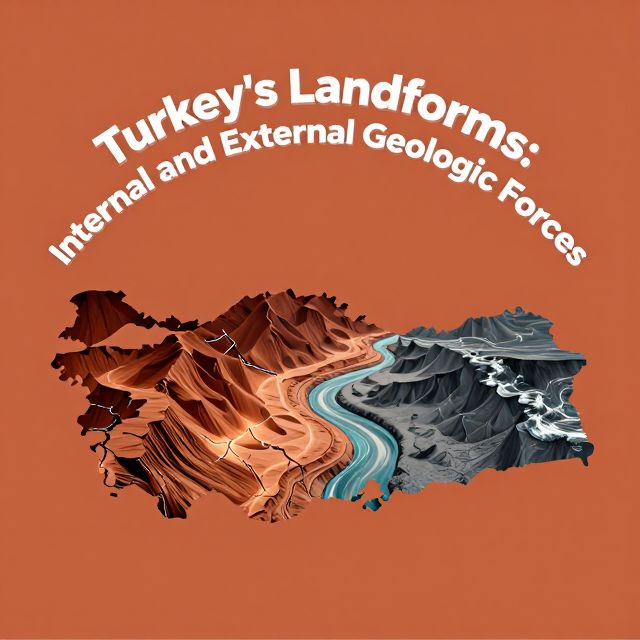
3️⃣ Resultant Landforms and Regional Examples in Turkey 🏞️

The interaction between internal and external forces has produced Turkey's rich and varied landforms. Internal forces establish the primary relief, while external forces subsequently sculpt and modify these features.

✅ Examples of Interaction:

  • Mountains and Valleys:

    • High mountain ranges (Pontic and Taurus) formed by orogenesis are continuously eroded by fluvial and glacial processes.
    • This leads to rugged terrains and deep valleys.
  • Central Anatolian Plateau:

    • Uplifted through epeirogenesis.
    • Extensively modified by wind and water erosion, resulting in rolling plains and isolated volcanic cones.
  • Western Anatolia:

    • Characterized by a series of horst and graben structures (e.g., the Büyük Menderes Graben).
    • Directly results from active faulting and subsequent erosion and deposition within these subsided blocks.
  • Mediterranean Region:

    • Renowned for extensive karst features, including sinkholes, poljes, and underground rivers.
    • All are products of chemical weathering of limestone.
  • Coastal Features:

    • The interplay of tectonic uplift or subsidence and marine erosion and deposition has created diverse features.
    • Ranges from rocky cliffs to sandy beaches and lagoons.
  • Fertile Alluvial Plains:

    • Examples: Gediz, Sakarya, and Yeşilırmak rivers.
    • Critical agricultural regions formed by the deposition of sediments carried by rivers originating in the interior mountains.
  • Volcanic Landscapes:

    • Volcanic activity has left a legacy of volcanic cones and extensive lava flows, particularly in Eastern Anatolia.
    • Contributes to its high elevation and unique geological character.

Conclusion: A Dynamic Geomorphological Landscape 💡

The diverse and complex landforms of Turkey are a direct consequence of the continuous and dynamic interaction between powerful internal and external geological forces.

  • Internal forces (plate tectonics, volcanism, seismic activity) are responsible for the initial creation of major relief features like mountain ranges, plateaus, and fault systems.
  • External forces (weathering, erosion by water, wind, ice, and subsequent deposition) relentlessly modify these primary structures, shaping valleys, plains, coastal features, and karst landscapes.

The ongoing nature of these processes ensures that Turkey's geomorphological landscape is in a constant state of flux, offering a compelling natural laboratory for the study of Earth sciences. A comprehensive understanding of these forces is fundamental to appreciating the country's physical geography, its natural resources, and its susceptibility to geological hazards.

Kendi çalışma materyalini oluştur

PDF, YouTube videosu veya herhangi bir konuyu dakikalar içinde podcast, özet, flash kart ve quiz'e dönüştür. 1.000.000+ kullanıcı tercih ediyor.

Sıradaki Konular

Tümünü keşfet
Turkey's Landforms: Internal and External Forces

Turkey's Landforms: Internal and External Forces

An academic overview of the geomorphological processes, specifically internal and external forces, that have shaped Turkey's diverse and dynamic landforms.

6 dk Özet 25 15 Görsel
Turkey's Landforms: Internal and External Forces

Turkey's Landforms: Internal and External Forces

This summary explores the geomorphological processes shaping Turkey's diverse landforms, focusing on the interplay of internal (tectonic, volcanic) and external (weathering, erosion) forces.

5 dk Özet 25 15 Görsel
Turkey's Landforms: Internal and External Forces

Turkey's Landforms: Internal and External Forces

An academic overview of the geomorphological processes shaping Turkey's diverse landscape, focusing on the interplay of endogenic and exogenic forces.

5 dk Özet 25 15 Görsel
Turkey's Landforms: Internal and External Geologic Forces

Turkey's Landforms: Internal and External Geologic Forces

This summary explores the geological processes shaping Turkey's diverse landforms, focusing on the interplay of internal (tectonic) and external (erosional/depositional) forces. Key geomorphological concepts are discussed.

5 dk Özet 25 15 Görsel
Turkey's Landforms: Internal and External Geological Forces

Turkey's Landforms: Internal and External Geological Forces

This summary explores the geological processes shaping Turkey's landforms, focusing on the interplay of internal tectonic forces and external erosional and depositional agents.

6 dk Özet 25 15 Görsel
Turkey's Landforms: Internal & External Forces

Turkey's Landforms: Internal & External Forces

Explore how internal and external geological forces have shaped Turkey's diverse landforms. Understand plate tectonics, volcanism, earthquakes, and the impact of erosion for your KPSS exam.

Özet 25 15
Turkey's Landforms: Internal and External Forces

Turkey's Landforms: Internal and External Forces

This summary explores Turkey's diverse landforms, analyzing how internal forces like plate tectonics, orogeny, and volcanism, alongside external forces such as weathering, erosion, and deposition, have shaped its unique geography.

6 dk Özet 25 15 Görsel
Earth Systems and Resources Overview

Earth Systems and Resources Overview

An academic summary of Earth's physical systems, including plate tectonics, soil dynamics, atmospheric composition, global climate drivers, and oceanic phenomena like ENSO.

8 dk 15 Görsel