Turkey's Landforms: Internal and External Forces - kapak
Eğitim#geography#turkey#landforms#geomorphology

Turkey's Landforms: Internal and External Forces

An academic overview of the geomorphological processes shaping Turkey's diverse landscape, focusing on the interplay of endogenic and exogenic forces.

roz1509May 13, 2026 ~19 dk toplam
01

Sesli Özet

5 dakika

Konuyu otobüste, koşarken, yolda dinleyerek öğren.

Sesli Özet

Turkey's Landforms: Internal and External Forces

0:005:08
02

Görsel Özet

İnfografik

Konunun tüm parçalarını tek bakışta gör.

Turkey's Landforms: Internal and External Forces - görsel özet infografik
Tam boyutta görüntüle →
03

Flash Kartlar

25 kart

Karta tıklayarak çevir. ← → ile gez, ⎵ ile çevir.

1 / 25
Tüm kartları metin olarak gör
  1. 1. What are the two main categories of forces that shape Turkey's landforms?

    Turkey's landforms are shaped by internal (endogenic) and external (exogenic) forces. Internal forces originate from within the Earth and create major relief features, while external forces operate on the Earth's surface, modifying and degrading these features. This dynamic interplay results in the country's diverse topography.

  2. 2. What is the primary characteristic of Turkey's topography due to its geological location?

    Due to its location at the convergence of major tectonic plates, Turkey exhibits a highly varied topography. This includes extensive mountain ranges, high plateaus, active fault lines, and diverse coastal features, all resulting from the complex interplay of geological processes originating both within the Earth and on its surface.

  3. 3. Define internal forces (endogenic processes) in the context of geomorphology.

    Internal forces, or endogenic processes, are geological forces that originate from within the Earth's interior. They are primarily driven by geothermal energy and are responsible for creating major relief features such as mountains, plateaus, and volcanic structures. These forces are fundamental in shaping the Earth's large-scale topography.

  4. 4. What is the main energy source driving internal forces?

    The main energy source driving internal forces (endogenic processes) is geothermal energy. This energy originates from the Earth's interior, powering processes like plate tectonics, volcanism, and mountain building, which ultimately shape the planet's major landforms and contribute to Turkey's complex geological structure.

  5. 5. How does Turkey's position within the Alpine Orogeny belt influence its internal forces?

    Turkey's position within the Alpine Orogeny belt means it is a region of intense mountain building. This belt is a result of the collision of the African and Arabian plates with the Eurasian Plate, leading to significant crustal shortening, uplift, and the formation of major mountain ranges like the North Anatolian and Taurus Mountains through intense folding and faulting.

  6. 6. Explain the process of orogenesis and name two major mountain ranges in Turkey formed by it.

    Orogenesis is the process of mountain building, primarily caused by the collision of tectonic plates, leading to intense folding and faulting of the Earth's crust. In Turkey, the North Anatolian Mountains and the Taurus Mountains are prime examples of ranges formed through this dominant internal force, resulting from the collision of the African and Arabian plates with the Eurasian Plate.

  7. 7. What is epeirogenesis and what significant landform in Turkey is attributed to it?

    Epeirogenesis refers to broad, regional uplift or subsidence of the Earth's crust, occurring over large areas without intense folding or faulting. In Turkey, this process has significantly contributed to the formation of high plateaus, such as the Central Anatolian Plateau, by causing large-scale vertical movements of the land over geological timescales.

  8. 8. Describe the role of volcanism as an internal force in Turkey and provide examples of volcanic features.

    Volcanism is a critical internal force in Turkey, particularly evident in Eastern and Central Anatolia. It involves the eruption of molten rock, ash, and gases, contributing significantly to the region's topography and soil composition. Examples include prominent stratovolcanoes like Mount Ararat, Mount Erciyes, and Mount Hasan, along with extensive volcanic plains.

  9. 9. What is seismicity and which major geological features in Turkey are responsible for it?

    Seismicity refers to the occurrence of earthquakes, which are a direct consequence of Turkey's active tectonic environment. Major fault zones, such as the North Anatolian Fault and the East Anatolian Fault, are responsible for high seismic activity. These faults cause ongoing landscape modification through fault-block formation, associated subsidence, and uplift.

  10. 10. Define external forces (exogenic processes) and their primary drivers.

    External forces, or exogenic processes, operate on the Earth's surface and are primarily driven by solar energy and gravity. These forces are responsible for the degradation, modification, and sculpturing of landforms initially created by internal forces. They include processes like weathering, erosion, and deposition, which continuously reshape the landscape.

  11. 11. What is weathering and what are its three main mechanisms?

    Weathering is the in-situ breakdown of rocks and minerals at or near the Earth's surface. Its three main mechanisms are physical (mechanical) weathering, chemical weathering, and biological weathering. Physical weathering involves disintegration without chemical change, chemical weathering involves decomposition, and biological weathering involves the action of living organisms, all contributing to rock breakdown.

  12. 12. Provide an example of physical weathering prevalent in Turkey.

    Physical weathering, such as frost wedging and thermal expansion, is prevalent in Turkey, especially in mountainous and continental climate regions. Frost wedging occurs when water freezes in rock cracks, expands, and pries the rock apart, while thermal expansion involves rocks expanding and contracting due to temperature changes, leading to fracturing and disintegration.

  13. 13. Where is chemical weathering particularly significant in Turkey and why?

    Chemical weathering, particularly the dissolution of soluble rocks, is significant in areas with limestone formations in Turkey. This process is especially prominent in regions like the Taurus Mountains, where water reacts with limestone to create distinctive karst landscapes, including caves, sinkholes, and underground drainage systems, due to the rock's solubility.

  14. 14. What is erosion and what are some of its primary agents?

    Erosion is the process by which weathered material (sediment) is transported from one location to another. It is facilitated by various agents, including water (fluvial erosion), wind (aeolian erosion), ice (glacial erosion), and gravity (mass wasting). Erosion plays a crucial role in shaping and modifying landforms by removing and redepositing material.

  15. 15. Describe fluvial erosion in Turkey and name two major rivers involved.

    Fluvial erosion, driven by rivers and streams, has extensively shaped Turkey's landscape by carving valleys, gorges, and deltas. Major rivers like the Kızılırmak, Yeşilırmak, Seyhan, and Ceyhan are significant agents, creating vast alluvial plains and riverine landscapes through the transport and deposition of sediment, constantly modifying the terrain.

  16. 16. What is aeolian erosion and where is it prominently observed in Turkey?

    Aeolian erosion, or wind erosion, is the process by which wind transports and deposits sediment, shaping landforms. It is prominently observed in arid and semi-arid regions of Turkey. A classic example is the formation of the 'fairy chimneys' in Cappadocia, where differential erosion of volcanic tuffs and ignimbrites by wind and water has created unique pillar-like structures.

  17. 17. Explain karst topography and its characteristic features, mentioning its location in Turkey.

    Karst topography is a specialized form of chemical erosion that occurs in regions with soluble bedrock, primarily limestone. It is widespread in the limestone-rich Taurus Mountains of Turkey. Characteristic features include caves, sinkholes (dolines), poljes (large closed depressions), and complex underground drainage systems, all formed by the dissolution of rock by groundwater over time.

  18. 18. How do coastal erosion and deposition modify Turkey's coastlines?

    Coastal erosion and deposition continuously modify Turkey's extensive coastlines along the Black Sea, Aegean Sea, and Mediterranean Sea. These processes are influenced by wave action, currents, and sea-level changes. They create diverse features such as sea cliffs through erosion, and beaches, spits, and lagoons through the deposition of sediment, constantly reshaping the shoreline.

  19. 19. Where can glacial erosion be found in Turkey and what features does it create?

    Glacial erosion, while less extensive than other forms of erosion in Turkey, is present in the highest mountain ranges. It involves the movement of glaciers, which scour and abrade the landscape. This process leaves behind distinctive features such as cirques (amphitheater-like valleys at the head of a glacier) and U-shaped glacial valleys, indicative of past or present glaciation.

  20. 20. What is the fundamental structural framework of Turkey primarily established by?

    The fundamental structural framework of Turkey, including its major mountain ranges, plateaus, and active fault systems, is primarily established by endogenic (internal) processes. These include orogenesis (mountain building), epeirogenesis (regional uplift/subsidence), volcanism, and seismicity, which originate from the Earth's interior and lay the groundwork for the country's topography.

  21. 21. How do exogenic processes modify the features created by endogenic processes in Turkey?

    Exogenic processes, such as fluvial, aeolian, karst, and coastal erosion, along with various forms of weathering, meticulously sculpt and modify the primary features created by endogenic processes. They break down, transport, and deposit material, leading to the intricate and diverse landscapes observed in Turkey today, refining the initial large-scale structures formed by internal forces.

  22. 22. What is the significance of Turkey's location at the convergence of major tectonic plates?

    Turkey's location at the convergence of major tectonic plates (African, Arabian, Eurasian) is highly significant because it drives intense internal forces. This convergence leads to active tectonics, causing extensive mountain building (orogenesis), widespread seismicity, and significant crustal deformation, resulting in its complex and varied topography and ongoing geological activity.

  23. 23. Name the two major fault zones responsible for high seismic activity in Turkey.

    The two major fault zones responsible for high seismic activity in Turkey are the North Anatolian Fault and the East Anatolian Fault. These active strike-slip faults accommodate the westward movement of the Anatolian Plate, leading to frequent earthquakes and ongoing modification of the landscape through fault-block formation and associated vertical movements.

  24. 24. How do volcanic eruptions contribute to both topography and soil composition in Turkey?

    Volcanic eruptions contribute significantly to Turkey's topography by building large stratovolcanoes and creating extensive volcanic plains, particularly in Eastern and Central Anatolia. Additionally, the ash and lava released during eruptions weather down to form fertile volcanic soils, which are rich in minerals and highly productive for agriculture, thus influencing both physical landscape and land use.

  25. 25. What is the primary difference in the origin of energy between internal and external forces?

    The primary difference in the origin of energy is that internal forces (endogenic) are driven by geothermal energy from the Earth's interior, while external forces (exogenic) are primarily driven by solar energy and gravity acting on the Earth's surface. This distinction highlights their different roles in shaping and modifying landforms, with internal forces building and external forces degrading.

04

Bilgini Test Et

15 soru

Çoktan seçmeli sorularla öğrendiklerini ölç. Cevap + açıklama.

Soru 1 / 15Skor: 0

What is the primary characteristic of Turkey's topography as described in the introduction?

05

Detaylı Özet

4 dk okuma

Tüm konuyu derinlemesine, başlık başlık.

This content is based on a YouTube video.

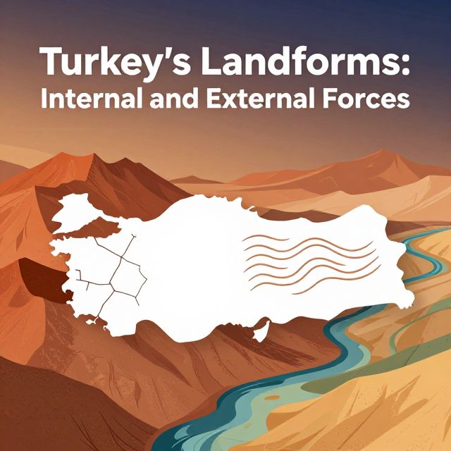
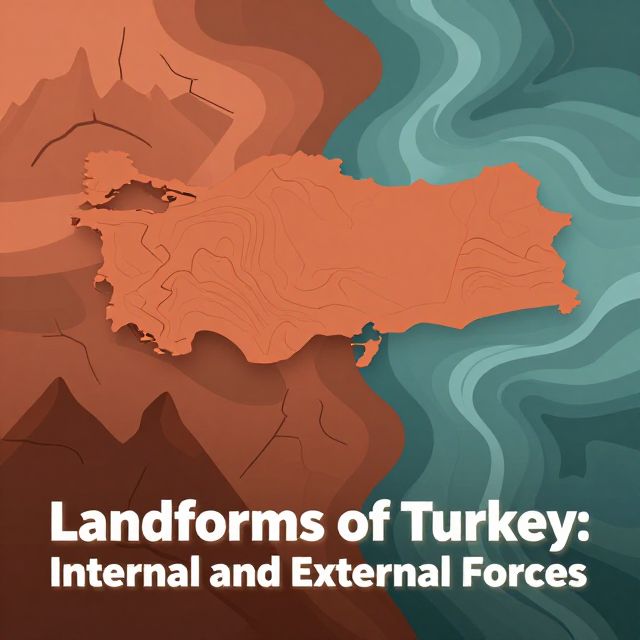
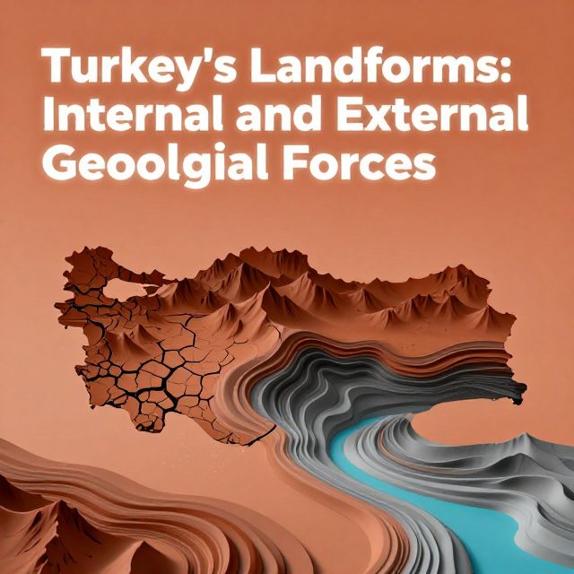
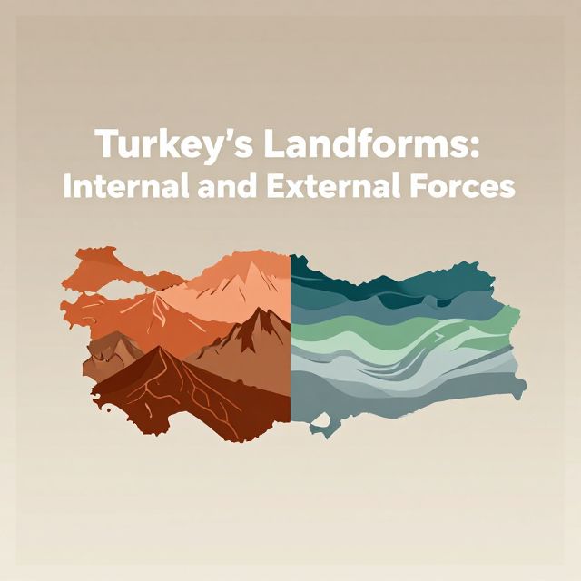
🌍 Turkey's Landforms: Internal and External Forces

Introduction to Turkish Geomorphology 📚

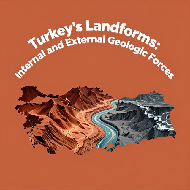
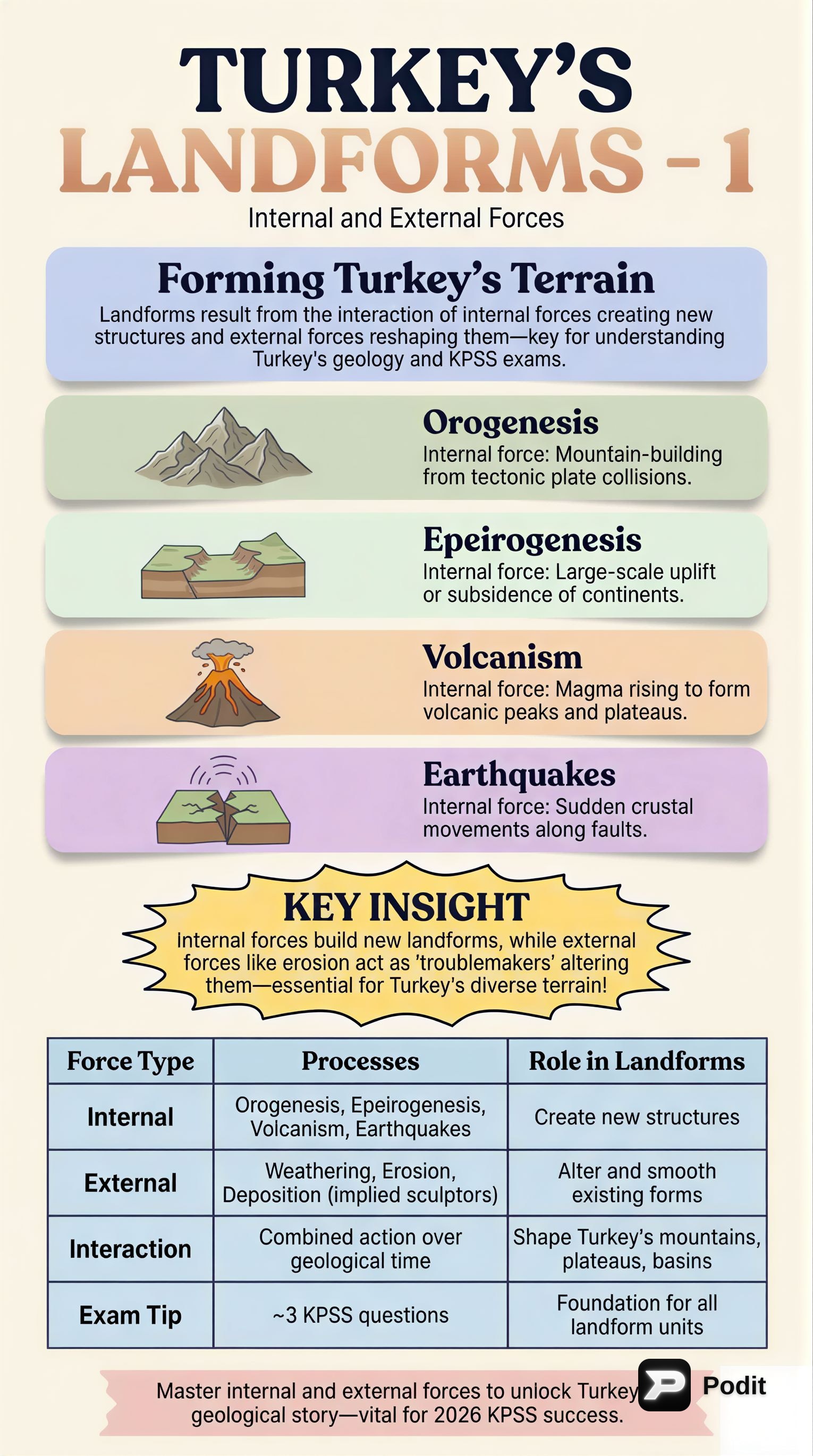
Turkey's diverse and complex topography is a result of dynamic geological processes occurring both within the Earth and on its surface. Situated at the convergence of major tectonic plates, Turkey exhibits a highly varied landscape, including extensive mountain ranges, high plateaus, active fault lines, and diverse coastal features. This study material outlines the fundamental internal (endogenic) and external (exogenic) forces responsible for shaping these distinctive landforms, providing a foundational understanding of the region's physical geography.

🌋 Internal Forces: Endogenic Processes

Internal forces, also known as endogenic processes, originate from the Earth's interior and are primarily driven by geothermal energy. These forces are crucial in creating major relief features.

Key Endogenic Processes in Turkey:

  • Orogenesis (Mountain Building) ⛰️
    • Definition: The process of forming mountain ranges through intense folding and faulting of the Earth's crust.
    • Cause: In Turkey, this is primarily due to its position within the Alpine Orogeny belt and the collision of the African and Arabian plates with the Eurasian Plate.
    • Result: Significant crustal shortening and uplift.
    • Examples: The extensive North Anatolian Mountains and the Taurus Mountains.
  • Epeirogenesis (Broad Uplift/Subsidence) 📈
    • Definition: Characterized by broad, regional uplift or subsidence of the Earth's crust without significant folding or faulting.
    • Contribution: Has contributed to the formation of high plateaus.
    • Example: The Central Anatolian Plateau.
  • Volcanism 🔥
    • Definition: The process by which molten rock (magma), ash, and gases are expelled from the Earth's interior onto its surface.
    • Prevalence: Particularly evident in Eastern and Central Anatolia.
    • Features: Numerous stratovolcanoes and extensive volcanic plains.
    • Examples: Mount Ararat, Mount Erciyes, and Mount Hasan, which have significantly influenced the region's topography and soil composition.
  • Seismicity (Earthquakes)
    • Definition: The occurrence or frequency of earthquakes in a region.
    • Cause: A direct consequence of Turkey's active tectonic environment.
    • Impact: Turkey is traversed by major fault zones, leading to high seismic activity and ongoing landscape modification.
    • Examples: The North Anatolian Fault and the East Anatolian Fault, responsible for fault-block formation, subsidence, and uplift.

🌬️ External Forces: Exogenic Processes

External forces, or exogenic processes, operate on the Earth's surface and are primarily driven by solar energy and gravity. These forces are responsible for the degradation and modification of landforms created by internal forces.

Key Exogenic Processes:

  • Weathering 🧱
    • Definition: The in-situ (on-site) breakdown of rocks and minerals at or near the Earth's surface.
    • Types:
      • Physical Weathering: Breakdown without chemical change.
        • Examples: Frost wedging (water freezing in cracks), thermal expansion (rock expansion/contraction due to temperature changes), prevalent in mountainous and continental climate regions.
      • Chemical Weathering: Breakdown involving chemical reactions.
        • Example: Dissolution of soluble rocks (e.g., limestone), particularly significant in areas with limestone formations.
      • Biological Weathering: Breakdown by living organisms (e.g., plant roots, animal burrowing).
  • Erosion (Transport of Weathered Material) 🌊
    • Definition: The process by which weathered material is transported from one location to another by agents like water, wind, ice, or gravity.
    • Agents and Features:
      • Fluvial Erosion (Rivers and Streams) 🏞️
        • Action: Carves extensive valleys, gorges, and forms deltas.
        • Examples: Major rivers like the Kızılırmak, Yeşilırmak, Seyhan, and Ceyhan have shaped vast alluvial plains and riverine landscapes.
      • Aeolian Erosion (Wind Erosion) 💨
        • Prevalence: Prominent in arid and semi-arid regions.
        • Features: Contributes to distinctive features.
        • Example: The fairy chimneys in Cappadocia, formed by differential erosion of volcanic tuffs and ignimbrites.
      • Karst Topography (Chemical Erosion of Soluble Rocks) 🕳️
        • Definition: A specialized form of chemical erosion occurring in limestone-rich areas.
        • Location: Widespread in the Taurus Mountains.
        • Features: Results in the formation of caves, sinkholes (dolines), poljes (large flat-floored depressions), and underground drainage systems.
      • Coastal Erosion and Deposition 🏖️
        • Influences: Wave action, currents, and sea-level changes.
        • Impact: Continuously modifies Turkey's extensive coastlines along the Black Sea, Aegean Sea, and Mediterranean Sea.
        • Features: Creates cliffs, beaches, and lagoons.
      • Glacial Erosion 🏔️
        • Extent: Less extensive than other forms but present in the highest mountain ranges.
        • Features: Leaves behind cirques (amphitheater-like valleys) and glacial valleys.

Conclusion: Interplay of Forces ✅

Turkey's remarkable and diverse landforms are a direct result of the continuous and dynamic interaction between powerful internal and external forces. Endogenic processes, including orogenesis, epeirogenesis, volcanism, and seismicity, established the fundamental structural framework of the region, creating its major mountain ranges, plateaus, and active fault systems. Subsequently, exogenic processes such as fluvial, aeolian, karst, and coastal erosion, along with various forms of weathering, have meticulously sculpted and modified these primary features, leading to the intricate landscapes observed today. Understanding this complex interplay is crucial for comprehending the geomorphological evolution of Turkey and for addressing associated environmental and geological challenges.

Kendi çalışma materyalini oluştur

PDF, YouTube videosu veya herhangi bir konuyu dakikalar içinde podcast, özet, flash kart ve quiz'e dönüştür. 1.000.000+ kullanıcı tercih ediyor.

Sıradaki Konular

Tümünü keşfet
Turkey's Landforms: Internal and External Forces

Turkey's Landforms: Internal and External Forces

An academic overview of the geomorphological processes, specifically internal and external forces, that have shaped Turkey's diverse and dynamic landforms.

6 dk Özet 25 15 Görsel
Turkey's Landforms: Internal and External Forces

Turkey's Landforms: Internal and External Forces

This summary explores the geomorphological processes shaping Turkey's diverse landforms, focusing on the interplay of internal (tectonic, volcanic) and external (weathering, erosion) forces.

5 dk Özet 25 15 Görsel
Landforms of Turkey: Internal and External Forces

Landforms of Turkey: Internal and External Forces

An academic overview of Turkey's landforms, examining the profound impact of both internal (endogenic) and external (exogenic) geological forces on its diverse topography.

7 dk Özet 25 15 Görsel
Turkey's Landforms: Internal and External Geologic Forces

Turkey's Landforms: Internal and External Geologic Forces

This summary explores the geological processes shaping Turkey's diverse landforms, focusing on the interplay of internal (tectonic) and external (erosional/depositional) forces. Key geomorphological concepts are discussed.

5 dk Özet 25 15 Görsel
Turkey's Landforms: Internal and External Geological Forces

Turkey's Landforms: Internal and External Geological Forces

This summary explores the geological processes shaping Turkey's landforms, focusing on the interplay of internal tectonic forces and external erosional and depositional agents.

6 dk Özet 25 15 Görsel
Turkey's Landforms: Internal & External Forces

Turkey's Landforms: Internal & External Forces

Explore how internal and external geological forces have shaped Turkey's diverse landforms. Understand plate tectonics, volcanism, earthquakes, and the impact of erosion for your KPSS exam.

Özet 25 15
Turkey's Landforms: Internal and External Forces

Turkey's Landforms: Internal and External Forces

This summary explores Turkey's diverse landforms, analyzing how internal forces like plate tectonics, orogeny, and volcanism, alongside external forces such as weathering, erosion, and deposition, have shaped its unique geography.

6 dk Özet 25 15 Görsel
Geographical Location: Absolute and Relative Aspects

Geographical Location: Absolute and Relative Aspects

An academic overview of absolute and relative geographical location, focusing on key concepts and their application to Turkey's geography, relevant for the KPSS examination.

8 dk Özet 25 15