Turkey's Landforms: Internal and External Forces - kapak
Eğitim#geography#geomorphology#turkey#landforms

Turkey's Landforms: Internal and External Forces

An academic overview of the geomorphological processes, specifically internal and external forces, that have shaped Turkey's diverse and dynamic landforms.

roz1509May 13, 2026 ~20 dk toplam
01

Sesli Özet

6 dakika

Konuyu otobüste, koşarken, yolda dinleyerek öğren.

Sesli Özet

Turkey's Landforms: Internal and External Forces

0:006:21
02

Görsel Özet

İnfografik

Konunun tüm parçalarını tek bakışta gör.

Turkey's Landforms: Internal and External Forces - görsel özet infografik
Tam boyutta görüntüle →
03

Flash Kartlar

25 kart

Karta tıklayarak çevir. ← → ile gez, ⎵ ile çevir.

1 / 25
Tüm kartları metin olarak gör
  1. 1. What is the primary reason for Turkey's varied and dynamic landscape?

    Turkey's diverse landscape is primarily due to its geographical position at the convergence of major tectonic plates and its span across various climatic zones. This unique location subjects the region to continuous geomorphological processes, leading to a complex topography of mountains, plateaus, and plains.

  2. 2. What are the two broad categories of geomorphological processes shaping Turkey's landscape?

    The two broad categories are internal (endogenic) forces and external (exogenic) forces. Internal forces originate from within the Earth's crust, deriving energy from the Earth's interior, while external forces act upon the Earth's surface, driven by solar energy and gravity.

  3. 3. What is the main characteristic of internal geomorphological forces?

    Internal forces are primarily responsible for shaping the large-scale structural features and high relief of Turkey. They derive their energy from the Earth's interior and include processes like tectonic movements, volcanism, and seismic activity, which are fundamental in building up the land's macro-topography.

  4. 4. Which internal force is largely responsible for Turkey's prominent mountain systems?

    Orogenesis, or mountain building, is largely responsible for Turkey's prominent mountain systems. This process is driven by the ongoing collision between the Eurasian and African-Arabian plates, forming ranges like the North Anatolian and Taurus Mountains through extensive folding, faulting, and uplift.

  5. 5. Name two major mountain ranges in Turkey formed by orogenesis.

    Two major mountain ranges formed by orogenesis in Turkey are the North Anatolian Mountains in the north and the Taurus Mountains in the south. These ranges are a direct result of the broader Alpine Orogeny, driven by the collision of tectonic plates, which created their high relief and complex structure.

  6. 6. What is epeirogenesis and how has it contributed to Turkey's topography?

    Epeirogenesis involves the broad uplift or subsidence of large continental areas without significant folding. In Turkey, it has contributed to the overall high elevation and the formation of extensive plateaus, particularly in Central and Eastern Anatolia, shaping the general elevation and flatness of these regions.

  7. 7. List three significant volcanic centers found in Turkey.

    Three significant volcanic centers in Turkey include Mount Ararat, Mount Suphan, and Mount Nemrut in Eastern Anatolia, as well as Mount Erciyes and Mount Hasan in Central Anatolia. These areas showcase the impact of volcanism on the landscape, creating distinctive landforms and enriching soils.

  8. 8. How does volcanism contribute to Turkey's landforms and soil?

    Volcanism creates distinctive landforms such as volcanic cones, extensive lava plateaus, and calderas. Additionally, volcanic activity has significantly enriched the soils in many regions, making them fertile and suitable for agriculture, which is a crucial benefit to local ecosystems and economies.

  9. 9. What are the major active fault lines traversing Turkey?

    Turkey is traversed by several major active fault lines, including the North Anatolian Fault, the East Anatolian Fault, and the West Anatolian Fault Zone. These fault lines are responsible for the country's high seismic activity and frequent earthquakes, which continuously reshape the landscape.

  10. 10. How does seismicity alter Turkey's landscape?

    Seismicity, or earthquake activity, causes rapid and significant alterations to the landscape. It leads to the formation of fault scarps, grabens (down-dropped blocks), and horsts (up-thrown blocks), contributing to the overall fragmentation and complex terrain of the country's active fault zones.

  11. 11. What is the cumulative effect of internal forces on Turkey's geography?

    The cumulative effect of internal forces is the creation of Turkey's fundamental geological framework and its high average elevation. These forces are responsible for the large-scale structural features, prominent mountain ranges, and extensive plateaus that define the country's macro-topography, setting the stage for external processes.

  12. 12. What is the primary energy source for external geomorphological forces?

    The primary energy source for external geomorphological forces is solar energy and gravity. These forces continuously modify and sculpt the macro-topography that was initially created by internal forces, shaping the Earth's surface features through processes like weathering, erosion, and deposition.

  13. 13. Define weathering and explain its two main types.

    Weathering is the disintegration and decomposition of rocks in situ, meaning without transport. Its two main types are physical weathering, which breaks rocks into smaller fragments without changing their chemical composition (e.g., freeze-thaw), and chemical weathering, which alters the rock's chemical composition (e.g., carbonation, oxidation).

  14. 14. Provide an example of physical weathering in Turkey.

    An example of physical weathering in Turkey is freeze-thaw cycles, particularly prevalent in mountainous regions. This process involves water seeping into rock cracks, freezing and expanding, which exerts pressure and gradually breaks the rock into smaller pieces, contributing to scree slopes.

  15. 15. In which type of rock is chemical weathering particularly effective in Turkey, and what landforms does it create?

    Chemical weathering is particularly effective in limestone-rich regions of Turkey. It contributes significantly to the formation of karstic landforms, such as caves, sinkholes (dolines), and travertine terraces, through processes like carbonation, where carbonic acid dissolves the soluble rock.

  16. 16. Which external force is arguably the most significant in Turkey, and what landforms does it create?

    Fluvial processes, driven by rivers, are arguably the most significant external force in Turkey. Rivers carve valleys and canyons, and deposit vast amounts of sediment to create fertile alluvial plains and deltas, such as the Çukurova, Bafra, and Çarşamba deltas, which are vital agricultural areas.

  17. 17. Name two major deltas in Turkey formed by fluvial processes.

    Two major deltas in Turkey formed by fluvial processes are the Çukurova Delta and the Bafra Delta. These highly fertile plains are created by rivers depositing sediment as they reach the sea, significantly contributing to agricultural productivity and supporting dense populations.

  18. 18. Where are glacial processes observed in Turkey, and what features do they sculpt?

    Glacial processes in Turkey are limited to the highest mountain peaks, such as Kaçkar and Uludağ, where conditions allow for ice formation. They sculpt distinctive features like cirques (amphitheater-like valleys), U-shaped valleys, and deposit moraines, which are accumulations of glacial debris, indicating past ice movement.

  19. 19. In which regions are wind (aeolian) processes prominent in Turkey, and what landforms do they create?

    Wind (aeolian) processes are prominent in arid and semi-arid regions of Turkey, particularly in Central Anatolia. They create landforms such as sand dunes, deflation hollows (depressions formed by wind erosion), and ventifacts (rocks sculpted by wind-blown sand), showcasing the power of wind as an erosional agent.

  20. 20. How do coastal processes reshape Turkey's extensive coastlines?

    Coastal processes, involving waves and currents, continuously reshape Turkey's extensive coastlines. They create various features including cliffs through erosion, beaches from sediment deposition, spits (narrow landforms extending from the coast), and lagoons, constantly modifying the interface between land and sea through dynamic interactions.

  21. 21. What are karstic processes, and where are they widespread in Turkey?

    Karstic processes are driven by the dissolution of soluble rocks, primarily limestone, by acidic water. They are widespread in Turkey, especially in the Taurus Mountains and the Antalya region, leading to unique underground and surface landforms due to the prevalence of soluble bedrock.

  22. 22. List three distinctive features formed by karstic processes in Turkey.

    Three distinctive features formed by karstic processes in Turkey are caves, sinkholes (known as dolines), and large depressions called poljes. Additionally, travertine terraces, like those in Pamukkale, are a notable karstic feature, formed by the precipitation of calcium carbonate from thermal waters.

  23. 23. What are mass movements, and what conditions favor their occurrence in Turkey?

    Mass movements include landslides, rockfalls, and soil creep, which are downslope movements of rock and soil under gravity. They are common in areas with steep slopes, unstable geology (e.g., fractured rocks, weak soil layers), and heavy rainfall, which saturates the ground and reduces friction, further modifying the landscape.

  24. 24. How do external forces generally interact with the macro-topography created by internal forces?

    External forces continuously modify and sculpt the macro-topography created by internal forces. While internal forces build up the large-scale features like mountains and plateaus, external forces meticulously refine these, creating the detailed surface features through processes like weathering, erosion, transportation, and deposition, acting as a sculpting agent.

  25. 25. Why is Turkey's landscape considered "ever-evolving and complex"?

    Turkey's landscape is considered "ever-evolving and complex" due to its unique geological setting at the junction of continental plates, combined with diverse climatic conditions. This ensures that both internal and external geomorphological processes remain highly active, constantly shaping and reshaping the land, leading to its intricate and dynamic nature.

04

Bilgini Test Et

15 soru

Çoktan seçmeli sorularla öğrendiklerini ölç. Cevap + açıklama.

Soru 1 / 15Skor: 0

Which of the following best describes the primary role of internal forces in shaping Turkey's geomorphology?

05

Detaylı Özet

4 dk okuma

Tüm konuyu derinlemesine, başlık başlık.

This content is based on a YouTube video.


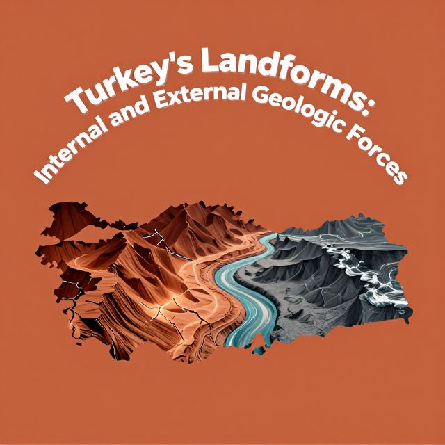
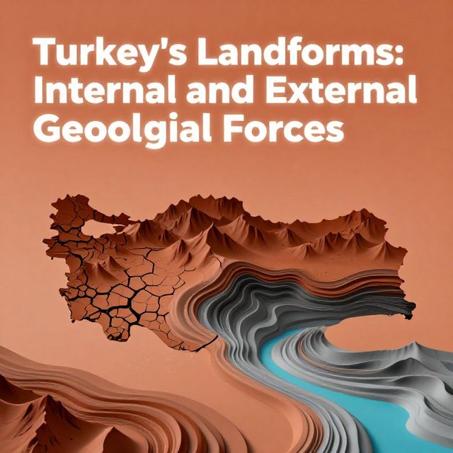
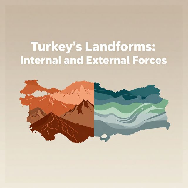
🌍 Turkey's Landforms: Internal and External Forces

Introduction to Turkey's Geomorphology 🇹🇷

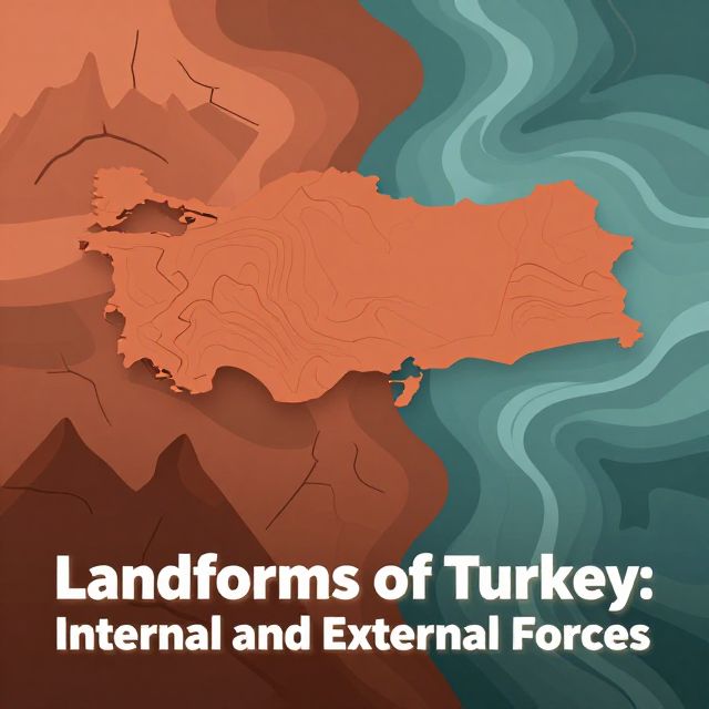
Turkey's diverse and dynamic landscape is a direct result of continuous geomorphological processes. Situated at the convergence of major tectonic plates and spanning various climatic zones, the country exhibits a remarkably varied topography, including high mountain ranges, extensive plateaus, fertile plains, and active fault lines. These landforms are shaped by two primary categories of forces:

  • Internal (Endogenic) Forces: Originating from within the Earth's crust.
  • External (Exogenic) Forces: Acting upon the Earth's surface.

Understanding the interplay of these forces is fundamental to comprehending the evolution and current state of Turkey's unique physical geography.


⛰️ Internal Forces: Shaping the Macro-Topography

Internal forces are responsible for the large-scale structural features and high relief observed across Turkey. They derive their energy from the Earth's interior.

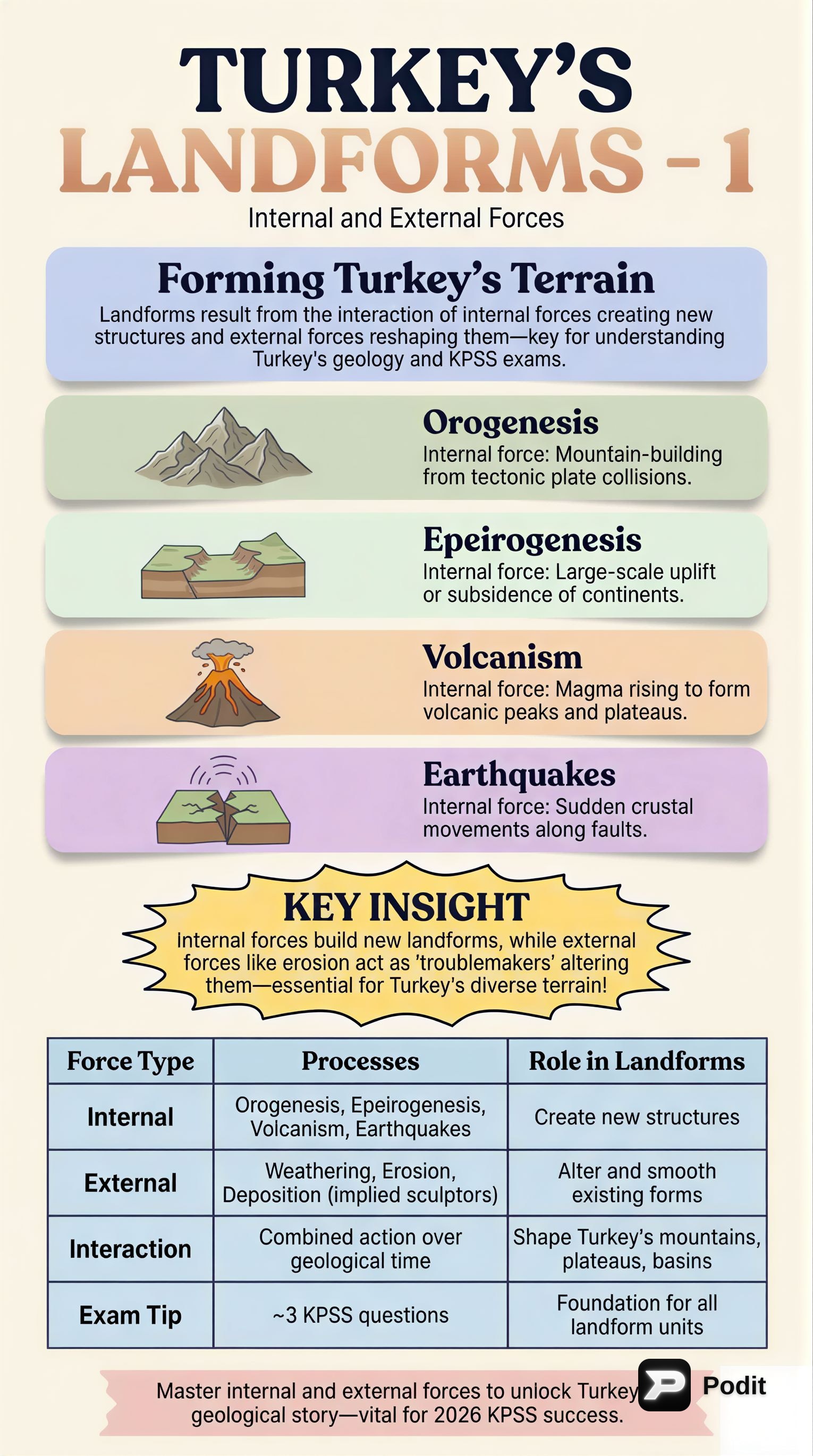
1. Tectonic Movements (Orogenesis & Epeirogenesis)

📚 Orogenesis (Mountain Building):

  • Definition: The process of forming mountain ranges through the folding and faulting of the Earth's crust.
  • Cause: Primarily driven by the ongoing collision between the Eurasian and African-Arabian plates. This is part of the broader Alpine Orogeny.
  • Impact in Turkey: Led to the formation of prominent mountain systems.
    • North Anatolian Mountains: Located in the north.
    • Taurus Mountains: Located in the south.
  • Characteristics: Extensive folding, faulting, and uplift.

📚 Epeirogenesis (Broad Uplift/Subsidence):

  • Definition: Involves the broad uplift or subsidence of large continental areas without significant folding.
  • Impact in Turkey: Contributes to the overall high elevation and plateau formation.
    • ✅ Particularly evident in Central and Eastern Anatolia.

2. Volcanism 🔥

  • Definition: The process by which molten rock (magma), ash, and gases are ejected from the Earth's interior onto its surface.
  • Impact in Turkey: Turkey hosts numerous extinct and active volcanic centers.
    • Eastern Anatolia: Mount Ararat, Mount Suphan, Mount Nemrut.
    • Central Anatolia: Mount Erciyes, Mount Hasan.
  • Landforms Created: Volcanic cones, lava plateaus, calderas.
  • Benefit: Enriches soils in many regions.

3. Seismicity (Earthquake Activity) ⚡

  • Definition: The occurrence of earthquakes, which are sudden releases of energy in the Earth's crust creating seismic waves.
  • Impact in Turkey: A pervasive internal force due to major active fault lines.
    • North Anatolian Fault (NAF)
    • East Anatolian Fault (EAF)
    • West Anatolian Fault Zone (WAFZ)
  • Alterations to Landscape: Rapid and significant changes.
    • ✅ Formation of fault scarps.
    • ✅ Creation of grabens (down-dropped blocks) and horsts (up-lifted blocks).
    • ✅ Contributes to the overall fragmentation of the terrain.

💡 Overall Effect of Internal Forces: The cumulative effect of these forces is the creation of Turkey's fundamental geological framework and its high average elevation.


🌊 External Forces: Sculpting the Surface Features

External forces continuously modify and sculpt the macro-topography created by internal forces. These exogenic processes are driven primarily by solar energy and gravity.

1. Weathering 🌬️

  • Definition: The disintegration and decomposition of rocks in situ (in place).
  • Types:
    • Physical Weathering: Breaks rocks into smaller fragments.
      • Examples: Freeze-thaw cycles in mountainous regions, salt crystallization in arid areas.
    • Chemical Weathering: Decomposes rocks through chemical reactions.
      • Examples: Carbonation, oxidation, hydrolysis. Particularly effective in limestone-rich regions, contributing to karstic landforms.

2. Erosion and Transportation 🏞️

These processes are carried out by various agents, moving weathered material.

  • Fluvial Processes (Rivers) 💧:

    • Significance: Arguably the most significant external force in Turkey.
    • Actions: Carve valleys, form canyons.
    • Deposition: Deposit vast amounts of sediment to create fertile alluvial plains and deltas.
      • Examples: Çukurova, Bafra, and Çarşamba deltas.
  • Glacial Processes (Ice) ❄️:

    • Extent: Limited to the highest mountain peaks.
    • Locations: Kaçkar and Uludağ mountains.
    • Landforms Created: Sculpted cirques, U-shaped valleys, deposited moraines.
  • Aeolian Processes (Wind) 💨:

    • Prevalence: Prominent in arid and semi-arid regions.
    • Location: Particularly in Central Anatolia.
    • Landforms Created: Sand dunes, deflation hollows, ventifacts.
  • Coastal Processes (Waves & Currents) 🏖️:

    • Action: Continuously reshape Turkey's extensive coastlines.
    • Landforms Created: Cliffs, beaches, spits, and lagoons.
  • Karstic Processes (Dissolution of Soluble Rocks) 🕳️:

    • Cause: Driven by the dissolution of soluble rocks like limestone.
    • Prevalence: Widespread, especially in the Taurus Mountains and the Antalya region.
    • Distinctive Features:
      • ✅ Caves
      • ✅ Sinkholes (known as dolines)
      • ✅ Large depressions (called poljes)
      • ✅ Travertine terraces

3. Mass Movements (Gravity) landslide

  • Definition: Downslope movement of rock, debris, or earth under the direct influence of gravity.
  • Commonality: Common in areas with steep slopes, unstable geology, and heavy rainfall.
  • Examples: Landslides, rockfalls, and soil creep.
  • Impact: Further modify the landscape.

💡 Overall Effect of External Forces: The continuous action of these forces refines the landforms, creating the detailed surface features that characterize Turkey's diverse geographical regions.


📊 Conclusion: The Dynamic Interplay of Forces

The intricate and varied landforms of Turkey are a testament to the dynamic and continuous interplay between powerful internal and external geomorphological forces.

  • Internal forces (plate tectonics, volcanism, seismicity) establish the fundamental structural framework, high relief, and major mountain systems, essentially creating the "canvas."
  • External forces (weathering, fluvial erosion, glacial action, wind, coastal processes, and karstification) then meticulously sculpt and refine these large-scale features, producing the detailed surface topography.

Turkey's unique geological setting at the junction of continental plates, combined with its diverse climatic conditions, ensures that these geomorphological processes remain highly active, leading to an ever-evolving and complex landscape. A comprehensive understanding of these forces is crucial for geological studies, natural hazard assessment, and regional planning within Turkey.

Kendi çalışma materyalini oluştur

PDF, YouTube videosu veya herhangi bir konuyu dakikalar içinde podcast, özet, flash kart ve quiz'e dönüştür. 1.000.000+ kullanıcı tercih ediyor.

Sıradaki Konular

Tümünü keşfet
Turkey's Landforms: Internal and External Forces

Turkey's Landforms: Internal and External Forces

An academic overview of the geomorphological processes shaping Turkey's diverse landscape, focusing on the interplay of endogenic and exogenic forces.

5 dk Özet 25 15 Görsel
Turkey's Landforms: Internal and External Forces

Turkey's Landforms: Internal and External Forces

This summary explores the geomorphological processes shaping Turkey's diverse landforms, focusing on the interplay of internal (tectonic, volcanic) and external (weathering, erosion) forces.

5 dk Özet 25 15 Görsel
Landforms of Turkey: Internal and External Forces

Landforms of Turkey: Internal and External Forces

An academic overview of Turkey's landforms, examining the profound impact of both internal (endogenic) and external (exogenic) geological forces on its diverse topography.

7 dk Özet 25 15 Görsel
Turkey's Landforms: Internal and External Geologic Forces

Turkey's Landforms: Internal and External Geologic Forces

This summary explores the geological processes shaping Turkey's diverse landforms, focusing on the interplay of internal (tectonic) and external (erosional/depositional) forces. Key geomorphological concepts are discussed.

5 dk Özet 25 15 Görsel
Turkey's Landforms: Internal and External Geological Forces

Turkey's Landforms: Internal and External Geological Forces

This summary explores the geological processes shaping Turkey's landforms, focusing on the interplay of internal tectonic forces and external erosional and depositional agents.

6 dk Özet 25 15 Görsel
Turkey's Landforms: Internal & External Forces

Turkey's Landforms: Internal & External Forces

Explore how internal and external geological forces have shaped Turkey's diverse landforms. Understand plate tectonics, volcanism, earthquakes, and the impact of erosion for your KPSS exam.

Özet 25 15
Turkey's Landforms: Internal and External Forces

Turkey's Landforms: Internal and External Forces

This summary explores Turkey's diverse landforms, analyzing how internal forces like plate tectonics, orogeny, and volcanism, alongside external forces such as weathering, erosion, and deposition, have shaped its unique geography.

6 dk Özet 25 15 Görsel
Earth Systems and Resources Overview

Earth Systems and Resources Overview

An academic summary of Earth's physical systems, including plate tectonics, soil dynamics, atmospheric composition, global climate drivers, and oceanic phenomena like ENSO.

8 dk 15 Görsel